Fit or Fat, There’s a Nature Hike to Suit You in Martinique
Hiking can be intimidating. Once you start down a trail, you typically have to keep going until you reach the end, which can be a problem if the knee sprain you sustained playing pick-up hoops starts acting up, or you haven’t been quite as diligent with your workout regimen as you’d like.
It’s easy to see how injuries and poor fitness can deter even the most ardent nature lovers from pursuing hiking adventures, but it doesn’t have to be that way… Not in the Caribbean, anyway.
Many destinations throughout the region offer a variety of hikes to suit all fitness levels. Take Martinique, for instance. There are a good 31 hiking trails totaling more than 80 miles scattered about the island, each of them well-marked and maintained by local authorities.
The variety of experiences is incredible, taking hikers through sugarcane and banana fields, up towering peaks, along sandy shores, and into the heart of the dense rainforest that dominates the northern section of the island.
Of course, some hikes are tougher than others…
For those whose fitness may be lacking, the Canal of the Slaves hike is perfect. This short (2.5 miles) jaunt follows the course of an irrigation canal built by slaves around 1770 to provide water for the towns of Le Carbet and Saint-Pierre. Beginning at Fonds-Saint-Denis, a small northern village just inland of Saint-Pierre, the trail follows an even path that borders the low wall of the canal. It’s not tough, but it is interesting, especially for history buffs like me who will appreciate the experience of walking in the footsteps of the slaves who carved the canal centuries ago.
Now, if you’re somewhere between fit and fat, then you’ll want to opt for the 12.4-mile hike connecting the northern towns of Prêcheur and Grand-Rivière. This lengthy excursion takes you along the northernmost section of Martinique where there’s no road connecting the Caribbean and Atlantic coasts. In fact, the only way to get from one coast to the other in this section of the island is by making this hike!
The trail hugs the coast past several Mornes (old, long-dormant volcanoes) that lie at the northern base of Mount Pelée. Along the way, hikers enjoy cascading rivers, waterfalls, rocky shoreline and dark sand beaches. The trail also winds across stone bridges and a tunnel counted among the last remaining vestiges of an old road that once connected the coasts back in the late 19th century. Hikers will also experience the ruins of Habitation Fond-Moulin, an old sugar factory long-abandoned.
The hike ends in the small fishing village of Grand-Rivière. All told, the excursion takes seven hours one-way, so appropriate transportation must be arranged.
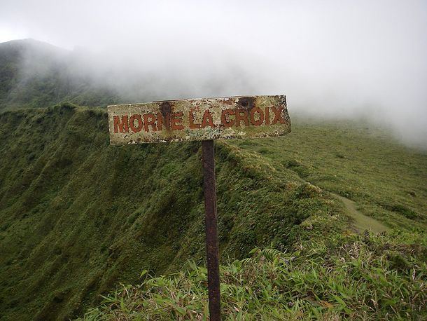
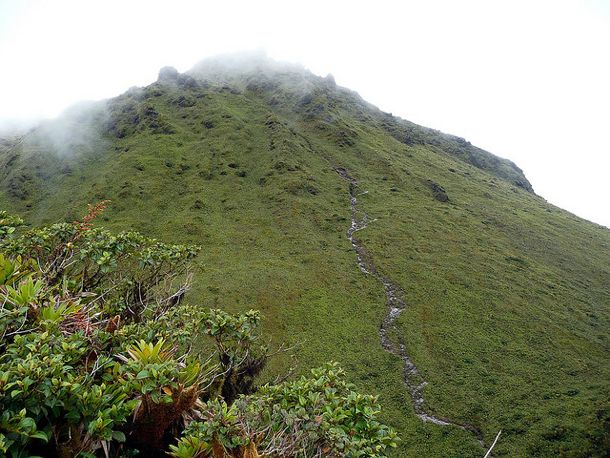
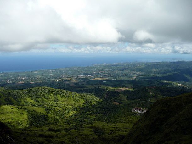
Certainly, the toughest hiking challenge Martinique has to offer is the grueling excursion to the summit of Mount Pelée. It’s only about four hours round-trip, but it’s a steep climb 4,600 feet up into the thin, cloudy air at the island’s highest peak. Combine the diminished O2 with slick conditions and loose footing, in spots, and you have a thrill-seekers hiking dream!
Your reward for reaching the summit: amazing views like this…
While the Canal of Slaves hike can easily be enjoyed on your own, you’re best off hiring a guide for the journey from Prêcheur to Grand-Rivière, or the excursion up Mount Pelée. To find one, click here to get in touch with our friends at the Martinique Promotion Bureau/CMT USA.
